Sponsored
moosehead
Well-Known Member
- Joined
- Sep 16, 2021
- Threads
- 64
- Messages
- 2,092
- Reaction score
- 4,594
- Location
- Denver, CO
- Vehicles
- ‘22 Ioniq 5, ‘78 Jeep Wagoneer
OverEasyGoing
Well-Known Member
- Joined
- Jul 18, 2023
- Threads
- 2
- Messages
- 106
- Reaction score
- 203
- Location
- San Francisco
- Vehicles
- '23 Wrangler, '23 R1S, '79 Scout, R2 Reserved
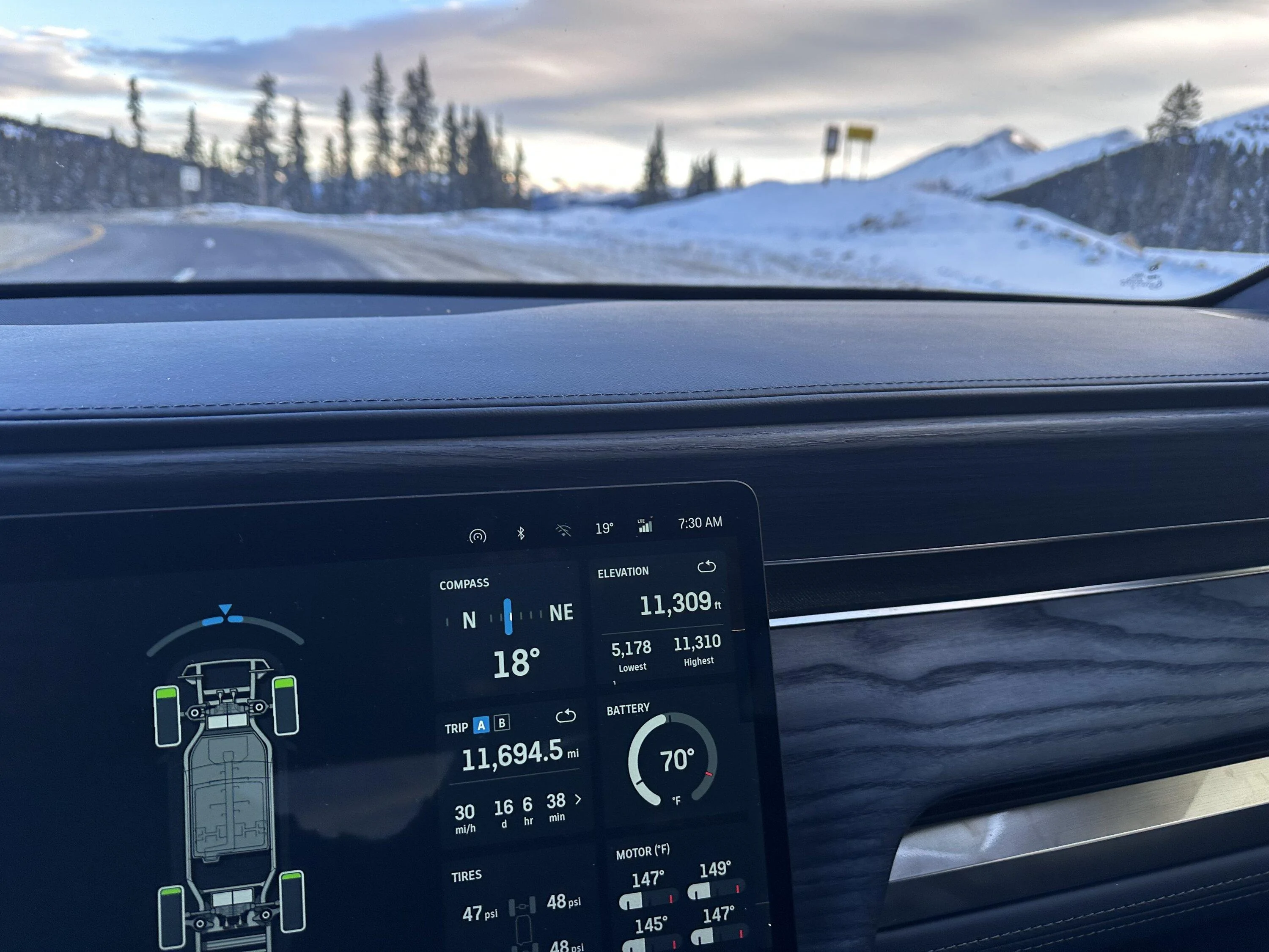
I'm just impressed that your lowest elevation is still 5178.
timgradywy
Well-Known Member
- First Name
- Tim
- Joined
- Jun 22, 2022
- Threads
- 3
- Messages
- 124
- Reaction score
- 155
- Location
- Bay Area CA
- Vehicles
- R1T, XC40 Recharge, CTS-V2, Triumph TR6.
Mine's ~7250 or 7300 feet right now. < sea level to over 7200 feet. This much difference is pretty easy going from the Bay Area to Tahoe.
R.I.P.
Well-Known Member
- First Name
- Sean
- Joined
- Jan 2, 2023
- Threads
- 13
- Messages
- 1,217
- Reaction score
- 1,681
- Location
- San Carlos, Mexico
- Vehicles
- Tesla Y, Cadillac ELR, Rivian R1T, Jeep TJ, F250
- Occupation
- Electrical Engineer
I cannot compete in the "Delta" race, but how about the "how low can you go" race...?
?

?
Sponsored
JamboF4
Well-Known Member
- First Name
- Jim
- Joined
- Oct 8, 2021
- Threads
- 18
- Messages
- 543
- Reaction score
- 404
- Location
- Ponte Vedra Beach, FL
- Vehicles
- R1T, C8 ZO6, Tacoma, Arcimoto
- Occupation
- Retired airline Captain
“Z” axis the most difficult for GPS accuracy
R.I.P.
Well-Known Member
- First Name
- Sean
- Joined
- Jan 2, 2023
- Threads
- 13
- Messages
- 1,217
- Reaction score
- 1,681
- Location
- San Carlos, Mexico
- Vehicles
- Tesla Y, Cadillac ELR, Rivian R1T, Jeep TJ, F250
- Occupation
- Electrical Engineer
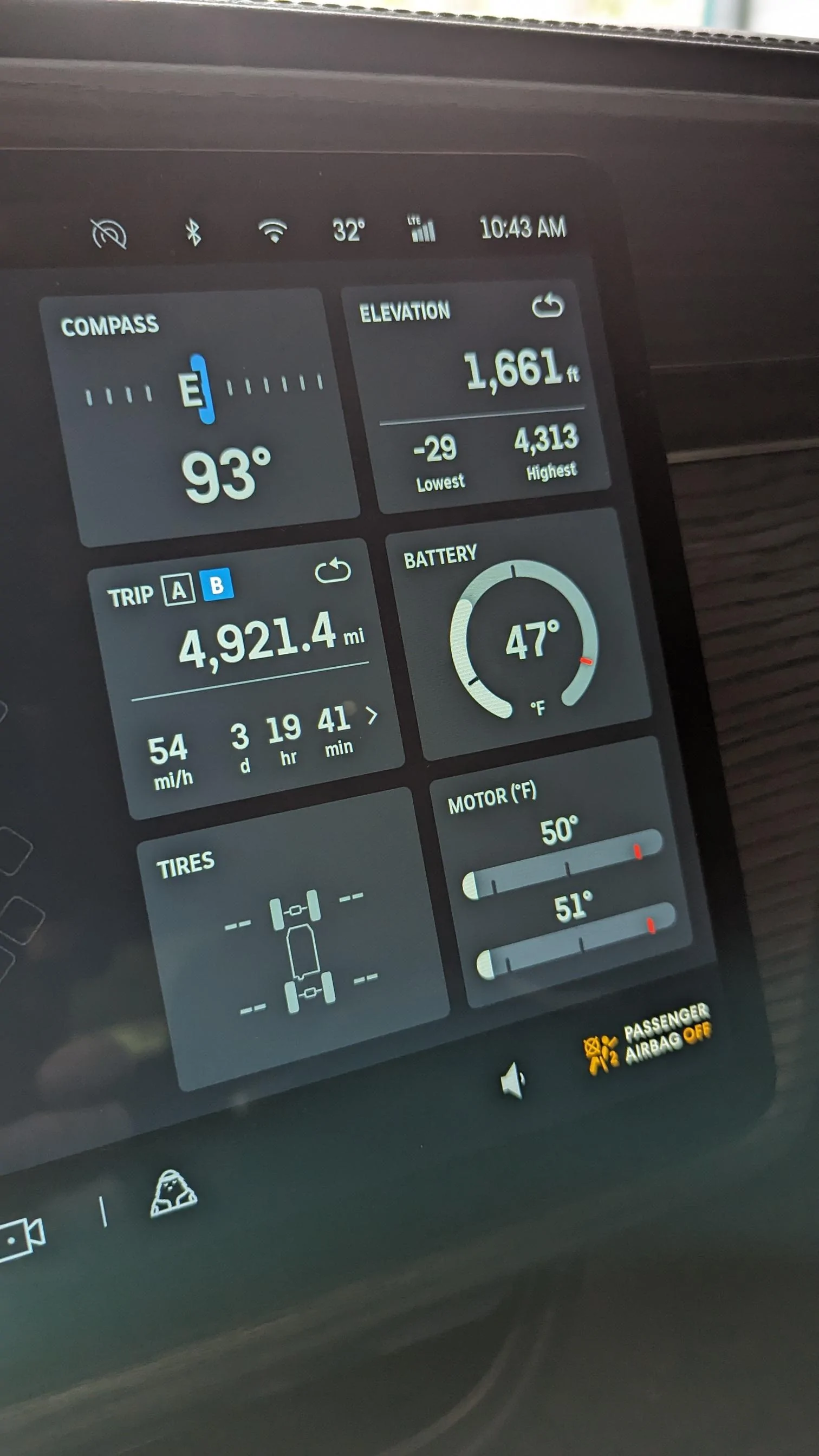
If you are referring to the negative elevation reading, that is accurate... running through Indio on my way to the PNW. There are so below sea level areas in NW Mexico as well.“Z” axis the most difficult for GPS accuracy
IGR
Well-Known Member
wow how do you not pass out?Who’s got the highest range in elevation? I’m a shade over 6k, but haven’t been very low since update.

I drove from see level to 6000 feet in one day, and I began to feel lightheaded...
JamboF4
Well-Known Member
- First Name
- Jim
- Joined
- Oct 8, 2021
- Threads
- 18
- Messages
- 543
- Reaction score
- 404
- Location
- Ponte Vedra Beach, FL
- Vehicles
- R1T, C8 ZO6, Tacoma, Arcimoto
- Occupation
- Retired airline Captain
Nope, not referring to any specific post. Only mentioning perceived altitude errors are common on commercial-grade GPS equip.….the Z axisIf you are referring to the negative elevation reading, that is accurate... running through Indio on my way to the PNW. There are so below sea level areas in NW Mexico as well.
WSea
Well-Known Member
- First Name
- Patrick
- Joined
- Mar 6, 2022
- Threads
- 39
- Messages
- 1,678
- Reaction score
- 2,044
- Location
- West seattle
- Vehicles
- R1T, Outback
- Occupation
- Architect
My lowest is -20 and I know the lowest I've been is officially 16
Sponsored
mpw81
Well-Known Member
Denver metro to the top of Loveland or Bethoud pass is 6000-7000' gain in 60 mins. Lots of people here do that weekly.wow how do you not pass out?
I drove from see level to 6000 feet in one day, and I began to feel lightheaded...
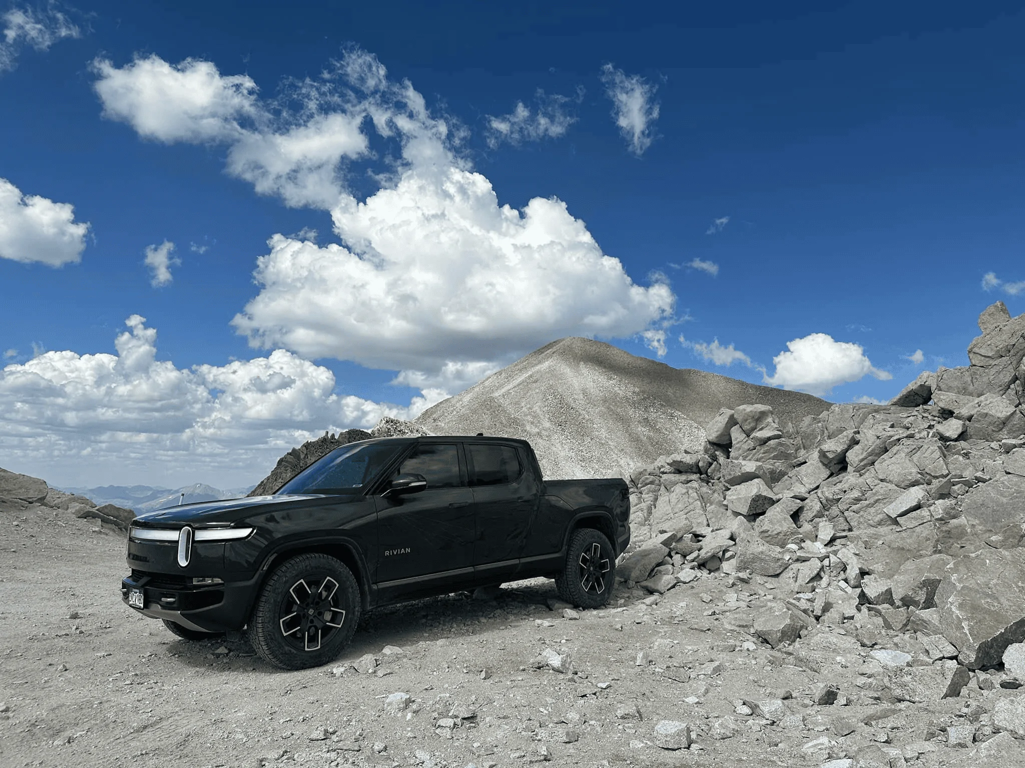
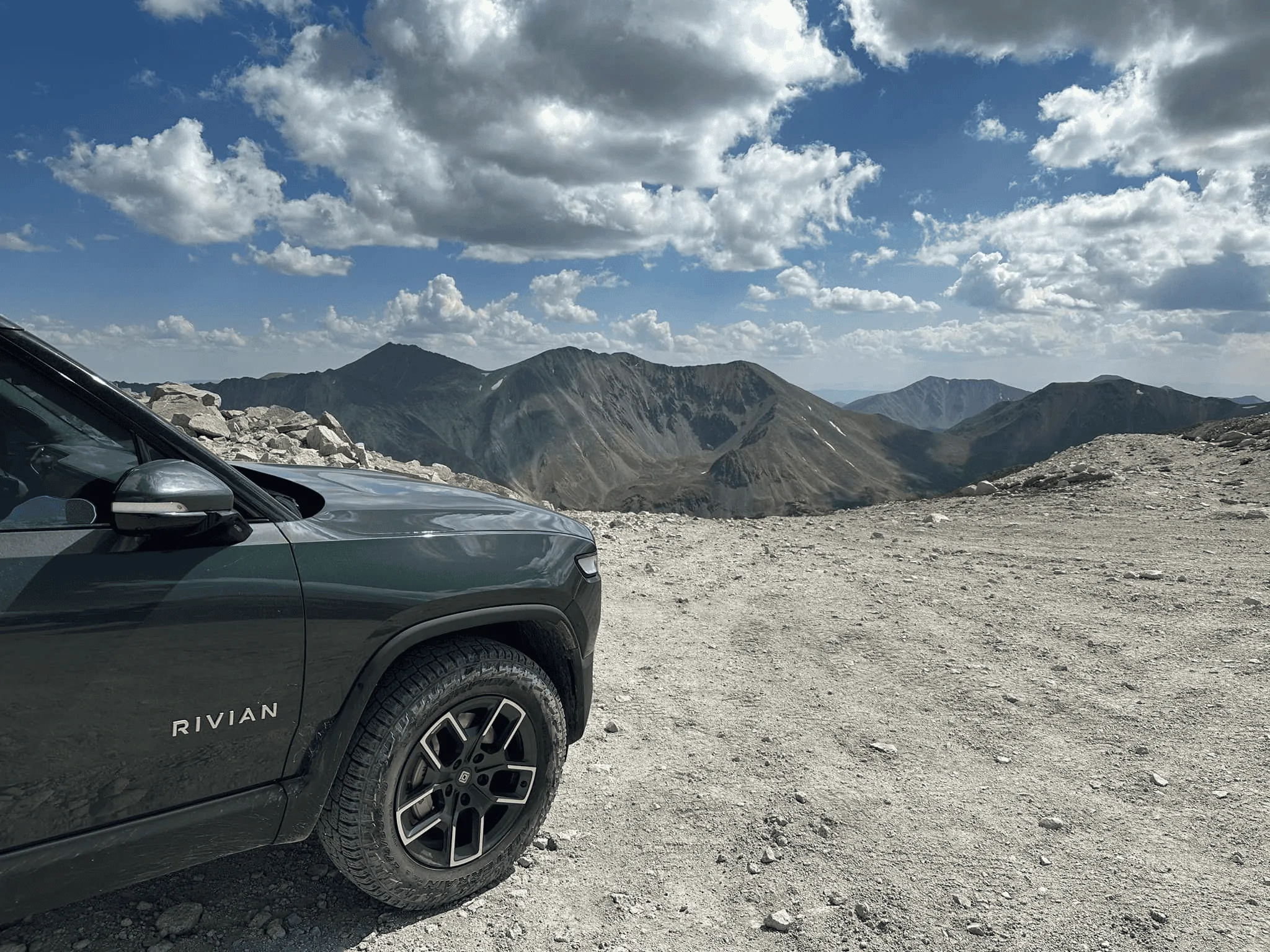
Denver to the top of Mt Blue Sky (I did this last year in my R1T) or C Springs to the top of Pikes's Peak can be done in 1-2 hours and are 8000-9000' gain.
Rivian engineer in a R1T did the Pike's Peak hill climb (so 4000-5000' gain) last year in a little over 11 minutes.
https://www.rivianforums.com/forum/...k-international-hill-climb-2023-result.16421/
runningdenver
Well-Known Member
Wish I had my R1S to play along. We live in Denver (5,280) and have a cabin in Leadville (10,200) that I go to every few weeks. Plenty of opportunity to get up higher there too. As mpw81 says, it's an easy drive up to Mt Blue Sky - the highest paved road in North America @ just over 14K. So guessing someone from here, who then goes on a road trip, should be able to get a 14K elevation delta.
zefram47
Well-Known Member
- First Name
- Aaron
- Joined
- Feb 6, 2022
- Threads
- 18
- Messages
- 2,752
- Reaction score
- 4,515
- Location
- Denver, CO
- Vehicles
- Rivian R1T, Alfa Romeo 4C
- Occupation
- Software Engineer
It was pre-gauge view, but I've been down to the low 4000 ft realm and as high as 13,800 ft at the top of Mt Antero (Buena Vista). Could probably go a bit higher driving up the paved road on Pikes Peak or Mt Blue Sky (formerly Evans), but what fun would that be. I'm talking about a trip to Chicago next month, so then probably around 600 ft to nearly 14k ft when I do.Who’s got the highest range in elevation? I’m a shade over 6k, but haven’t been very low since update.
JamboF4
Well-Known Member
- First Name
- Jim
- Joined
- Oct 8, 2021
- Threads
- 18
- Messages
- 543
- Reaction score
- 404
- Location
- Ponte Vedra Beach, FL
- Vehicles
- R1T, C8 ZO6, Tacoma, Arcimoto
- Occupation
- Retired airline Captain
Yes..a pat on the back for understanding why! HahaMy lowest is at -520 (and I've never been below 0, so it's all GPS error). Does that get me something?
Sponsored